Geology rocks up to your desktop
- Complaining about the Mainland - 17th August, 2024
- New island designation – is it just greenwash? - 26th April, 2024
- Police and Crime Commissioners – a solution or a problem? - 21st April, 2024
The British Geological Survey has long been the alma mater of Britain’s rock nerds. Now it’s coming to your desktop – or pocket – with an impressive array of geology-based information free-to-use.

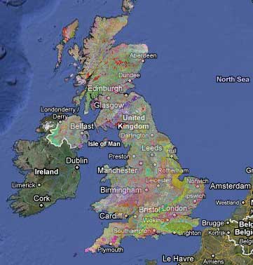
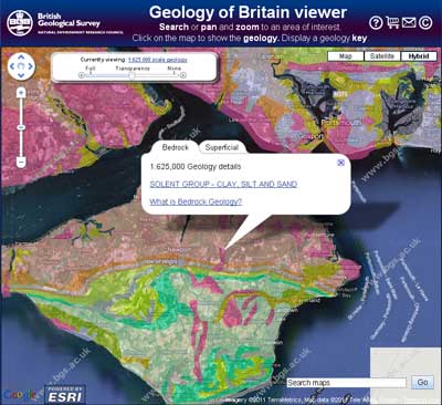
Across the whole of the UK the geological map is now available via the familiar Google Maps interface. You can see the zoomed-out view in the image above, but the fun bit is when you get to centre in on an area, and the detail starts to emerge. There’s even a (slightly intrusive) pop-up which tells you the name of the rocks and deposits your map view is centred upon. The enticing link to click on, unfortunately, doesn’t really provide any more information as yet, but obviously in due course it could. And you could always take the name of the deposit and ask Google.

Of course, dare I say, what would be really impressive and useful would be the ability to take this out into the field. Hold, on, it looks as though BGS are way ahead of me.
iGeology is a new free smartphone App that lets you take a geological map of Britain with you wherever you go to help you learn about the rocks beneath your feet. And with the phone’s GPS, you’ll know exactly where you are.
It’s available for both Apple and Android. And it’s free for non-commercial use. That’s got to be worth the money. This is a really great example of public data being made available and used for beneficial purposes. BGS know this, and comment on their website:
We hope that the release of iGeology, and OpenGeoscience, will help us develop new and innovative ways to use our information to help solve the problems facing humankind today; climate change, sustainable energy or geological hazards such as earthquakes or landslides. By harnessing the power of the public we may soon be able to’crowdsource’ ideas that may help reduce the impact of these issues. iGeology is just the start of this process and in the future, for example, we may be able to get felt observations of earthquakes, gather video or georeferenced photos, or as technology advances, use mobile phones as seismometers.
I wonder when there will be an iBiodiversity app?


This is very cool. Any idea whether there are plans to integrate it with NBN so you can overlay botanical or invertebrate data with geological data? I’ve been having fun with the NBN’s interactive maps recently and I’d love to be able to do that. Ferny
Finally some really useful apps for those interested in natural sciences. This is fantastic! We don’t have this in the States yet, but perhaps we will.
Yes, a biodiversity app would be even better!
iBiodiversity… would be good!
There’s always the NBN Gateway, although I don’t think it works properly on mobiles yet – will have to check.
There is a definite movement towards integrating biodiversity records and mobile technology – Oxford held a conference on it very recently: http://digitalconservation.wordpress.com/2011/02/02/smartphone-symposium/